3 More Great Days on the Willamette River - Part 1
June 2014 - Eugene to Corvallis by Kayak and Canoe
After our three-day paddle last year, Jim, Shalline, Chuck and I had decided to come back again and do more of the Willamette. Unfortunately, Jim could not make the trip, so it was just the three of us that would paddle from Armitage Park on the McKenzie River to Corvallis. We had three days available, May 29, 30 and 31, which, combined with a good river current, allowed us to have easy paddling with beautiful weather.
Our trip took us from three-miles above Willamette river mile (RM) 175 to RM 131 for a
total distance of about 48 statute miles. My wife
Janet did the driving and took us up to Armitage Park on Thursday and picked us back up at Corvallis. Thanks, Janet!
This web page is part one, covering our first day.
Part 2 covers the second and third days.
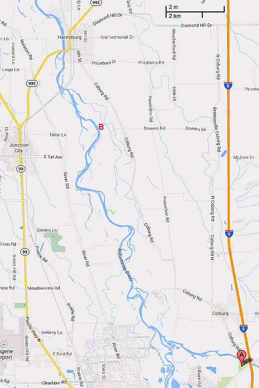
The north-flowing Willamette River starts in the hills and mountains around Eugene, Oregon. On this map, it appears from the bottom edge, just after flowing through the city. We did not travel on that part of the river, but instead started on the McKenzie River at the point marked by the "A" tack. This is an easy point to put in at and has a good ramp, all run by Lane County.
Where they flow together to the left of the "A", the McKenzie and the Willamette are fully deserving of the descriptor "river." The detailed flow rates depend upon the dams upstream, but when we were making our trip, they were similar, with roughly 3000 cubic feet per second coming from each.
The point marked "B" is "Blue Ruin Island," and was our first nights stop. This was about 14 miles from our put-in. The next map will show the remainder of our trip.
The river flow on the McKenzie was high enough to make the paddling interesting. But, not high enough to fully cover all the rocks. This creates many places where the choice of lateral position on the river was a challenge. At least as viewed from my kayak, I could choose between bumping on rocks below the surface or working through some confused water on the deep side. But, we came through fine and by the time we joined up with the Willamette, the river had slowed considerably.
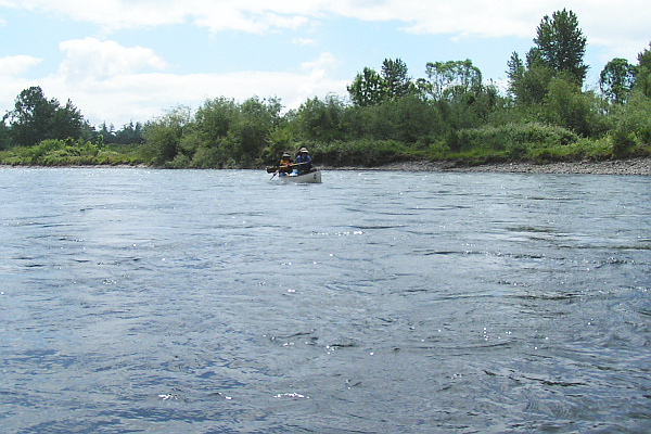
To the left we see Shalline and Chuck nimbly picking there way down the McKenzie in their canoe.
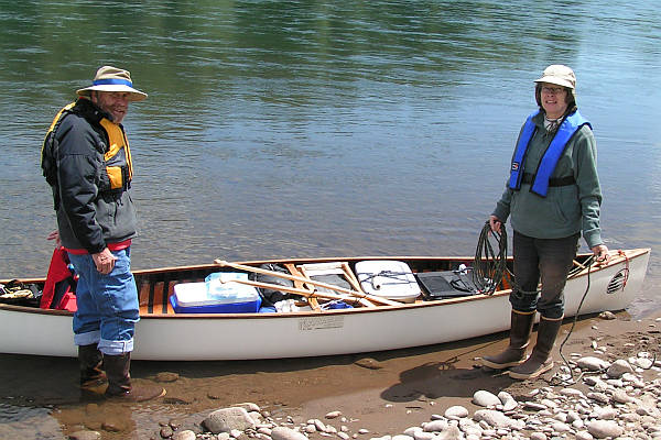
We stopped for lunch on a random gravel bar. Shalline and Chuck have their canoe well organized, as can be seen here. While we were eating, the Lane County sheriff's boat came by. They checked our preparedness and headed off---apparently satisfied!
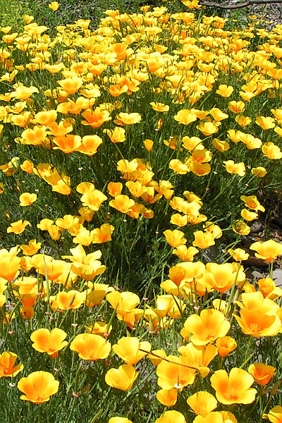
Our lunch-stop gravel bar must have looked good to the California Poppies. They were mixed with white daisies and thriving.
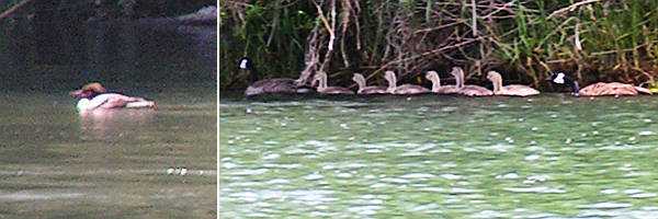
Watching bird life is a continual part of paddling the river. On the left is a Common Merganzer, a specie that we found in a number of locations. On the right is a family of Canada Geese, apparently well adapted to never going to Canada.
The river oriented species we watched included the two species above plus Kingfishers,
Water Ouzels, Cormorants, Bald Eagles, Osprey, Great Blue Herons (it seems like the GBH population is down---does this reflect the success of the Eagles and Osprey?) and Mallards.
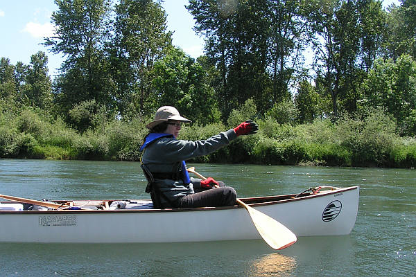
Here we have Shalline leading the way! Compare this picture with the one of Bob and Chuck in Part 2.
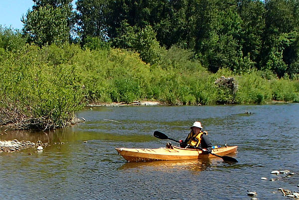
By about 3 PM we were at Blue Ruin Island and found a good beach for camping on the west (main channel) side. Shalline took this picture of me working my way down on some still water inside the island. Before this, I had gotten out and pulled the kayak over the shallows at the head of the island.
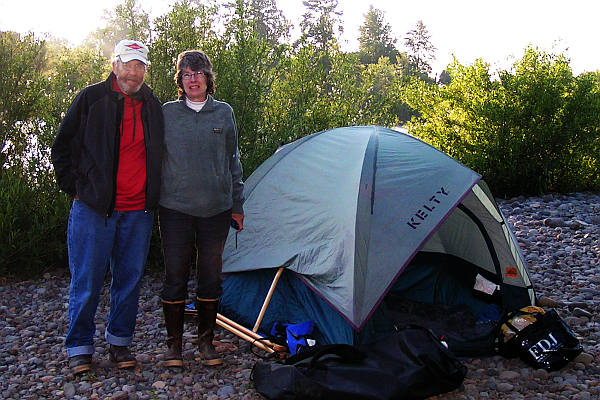
This is camping on Blue Ruin Island (RM164.5). It is a good idea to use a sleeping mat!
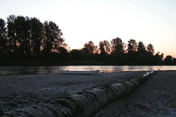
The end of our first day of the trip!
This page was last updated 3 June 2014
Please email comments or corrections to bob 'the at sign' janbob dot com